报告详情
Topographic evolution following the 2000 Yigong landslide cascade: insights from reconstructed multi-temporal TanDEM-X DEMs
编号:103
访问权限:仅限参会人
更新:2026-08-04 10:13:35
浏览:61次
口头报告
报告开始:2026年08月11日 16:55(Asia/Hong_Kong)
报告时间:15min
所在会场:[S12] Session 12 AI-Enabled Geohazard Risk Reduction [S12] Session 12 Day 3
暂无文件
摘要
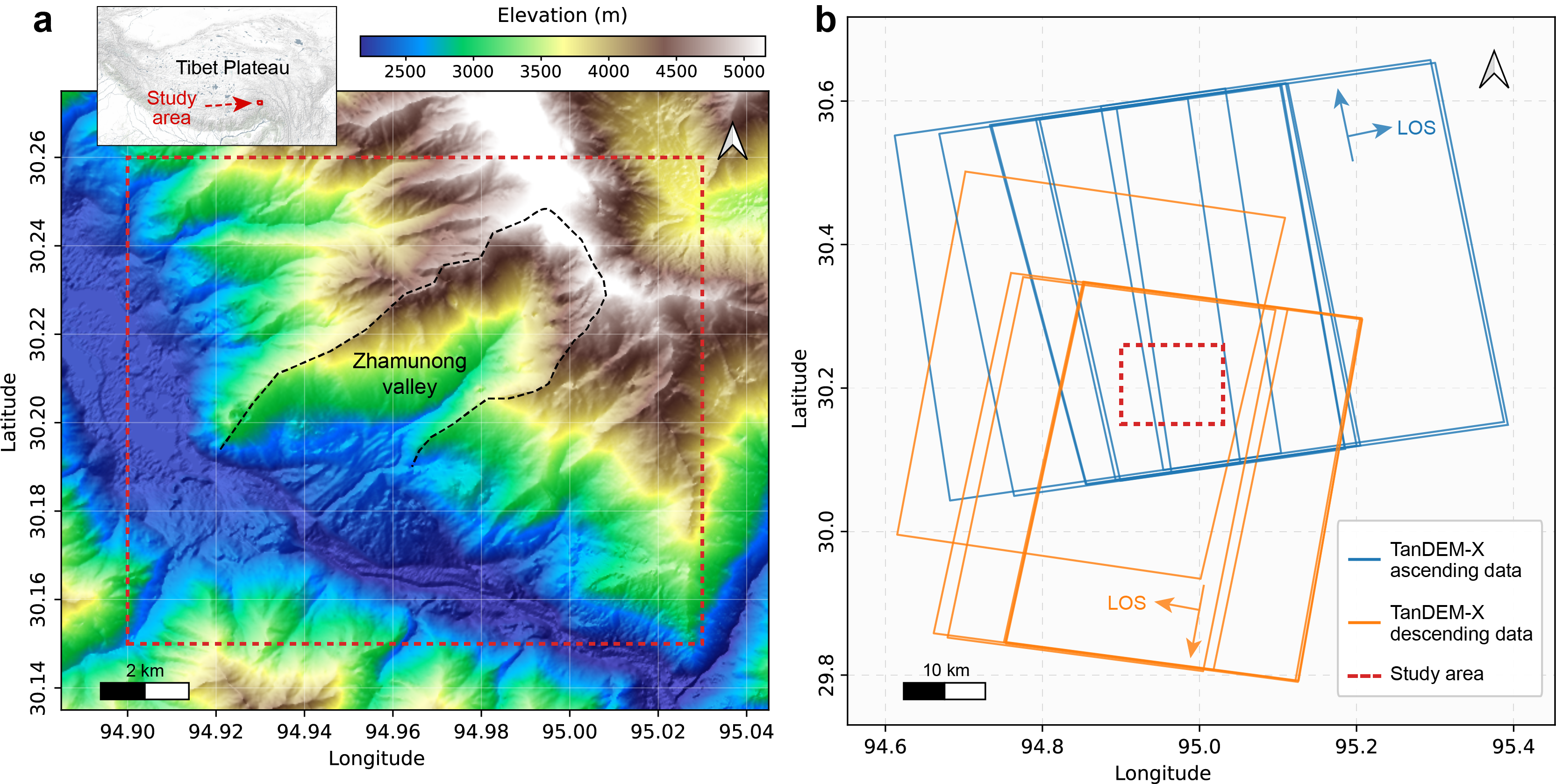
Large landslide cascades can trigger long-term geomorphic adjustment, yet post-event topographic changes remain difficult to observe in high mountain valleys. This study reconstructs multi-temporal TanDEM-X DEMs from 2011 to 2023 and uses them to estimate multi-year linear elevation-change rates after the 2000 Yigong landslide cascade. The workflow combines coherence and radar-geometry screening, effective observation counts, bias correction using stable reference areas, and land-cover-based interpretation using ESA WorldCover data. A total of 36 candidate elevation-change patches were identified, covering approximately 0.052 km². These patches include snow and ice surface changes, deposit-related lowering and thickening, and tree-cover surface signals. Surface lowering in snow- and ice-covered terrain was the dominant signal by area, with a median elevation-change rate of approximately -2.21 m/yr. The results indicate that the reconstructed multi-temporal TanDEM-X DEMs provide useful spatial evidence for analyzing post-landslide topographic evolution and locating possible instability or deposit-adjustment areas in complex mountain environments.
关键词
TanDEM-X,multi-temporal DEM,landslide cascade,high mountain terrain,Himalaya
报告人

Bo ZHANG
Tongji UniversitySee Bo Zhang
稿件作者
全部评论
重要日期
-
会议日期
08月09日
2026
至08月13日
2026
-
08月06日 2026
初稿截稿日期
-
08月12日 2026
注册截止日期
主办单位
The Hong Kong Polytechnic University
承办单位
International Consortium on Geo-disaster Reduction (ICGdR)


发表评论